ntv
USA-Arizona-Gran-Canyon-Noth-Rim-View-Point
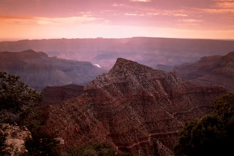
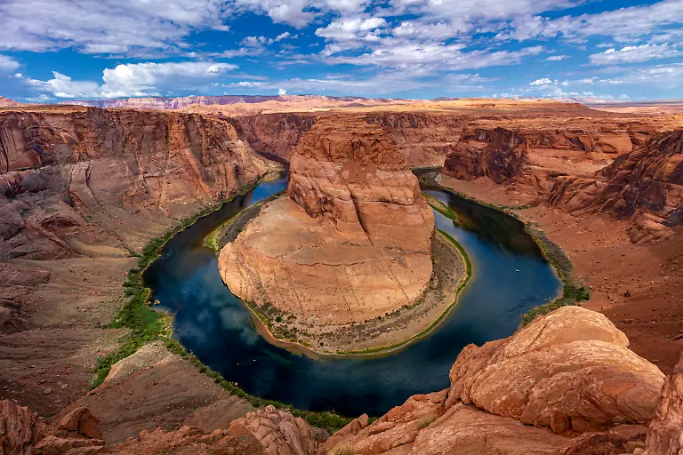
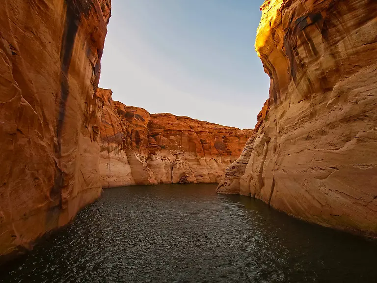
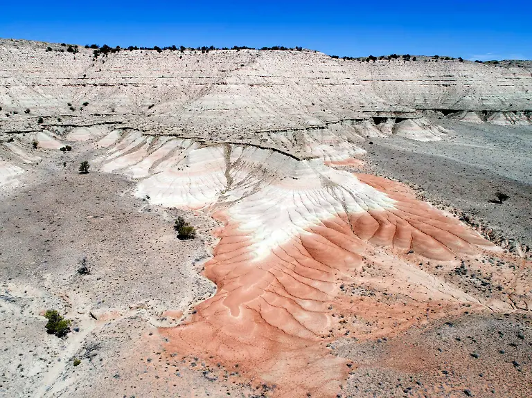
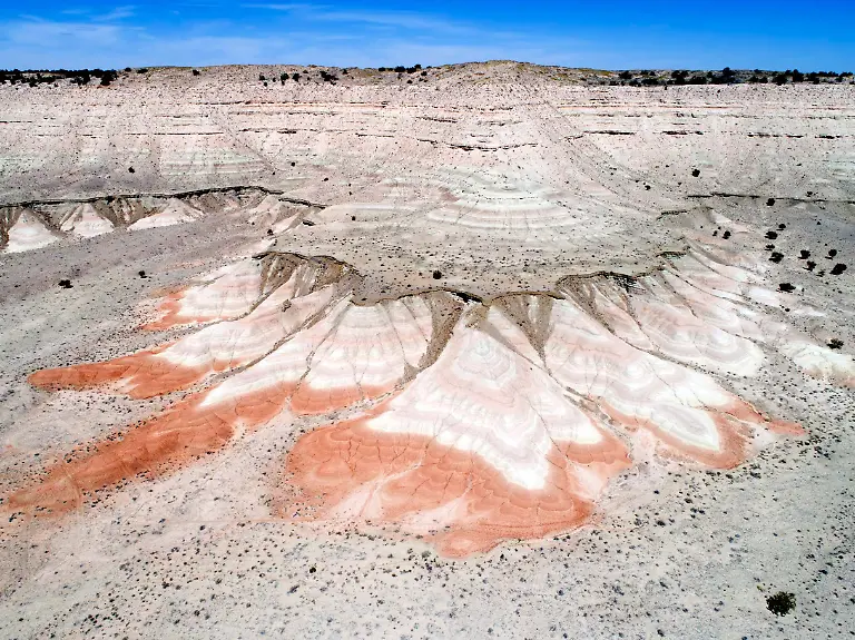
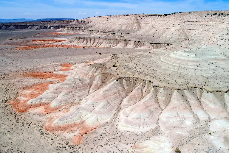
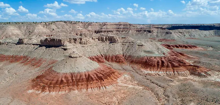
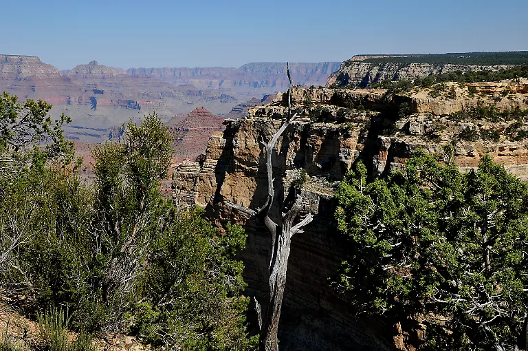
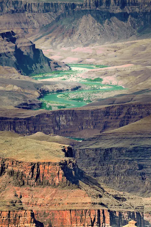
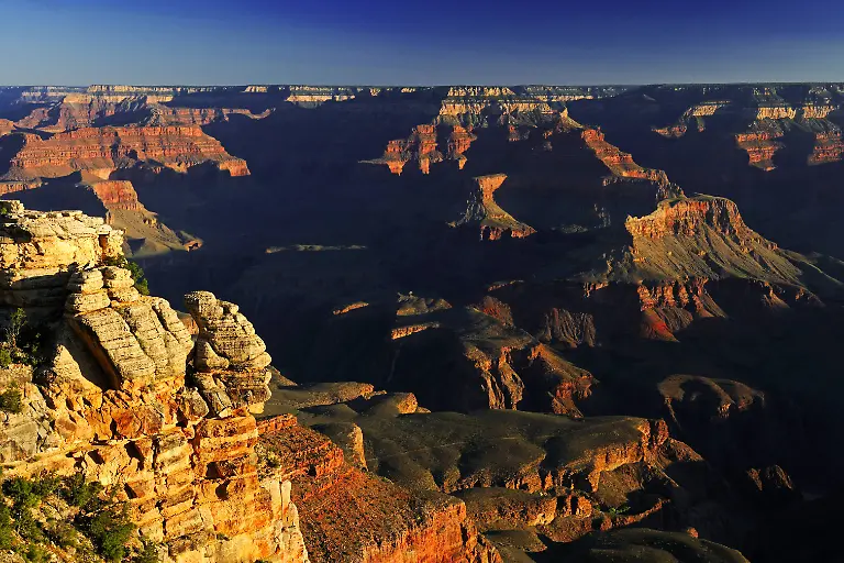
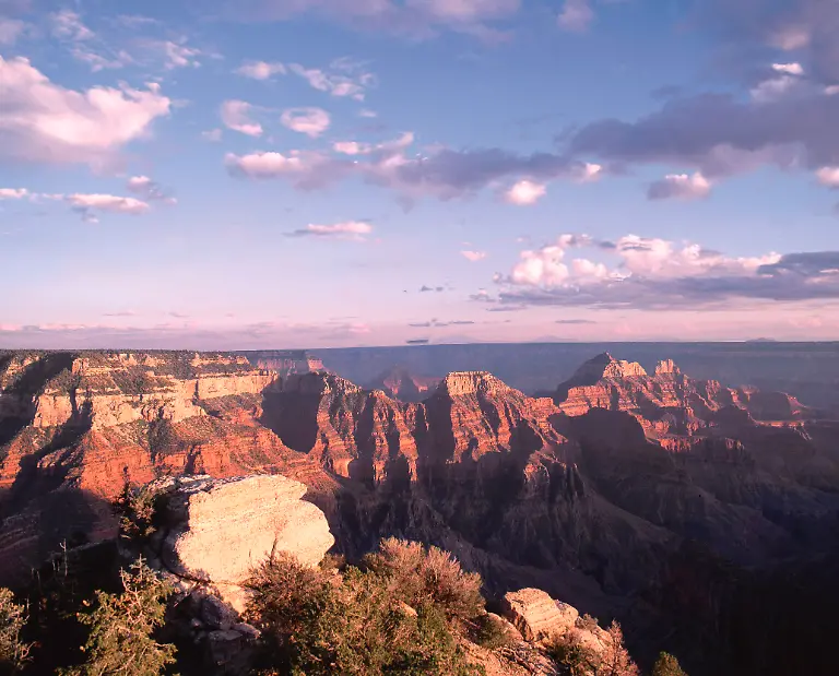
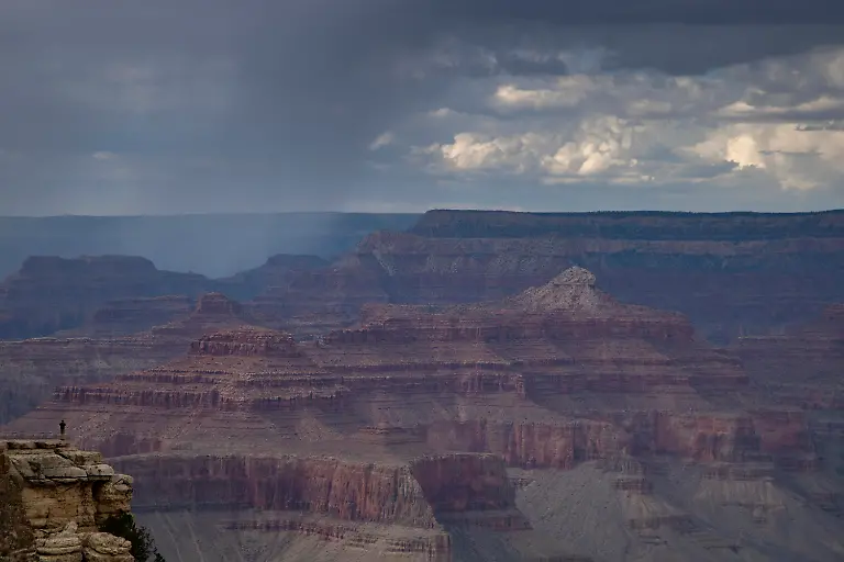
Der Grand Canyon in den USA gehört zu den spektakulärsten Regionen, die die Natur auf der Erde hervorgebracht hat.Bild 1 von 37 | Foto: picture alliance / Global Travel Images
geography-travel-USA-Arizona-Grand-Canyon-National-Park-Grand-Canyon-East-Rim-Drive-scenic-landscape
Die Schlucht, die sich über 450 Kilometer vom Nordosten nach Westen im Norden des US-Bundesstaates Arizona erstreckt, ...Bild 2 von 37 | Foto: picture alliance / Artcolor
Grand-Canyon-national-park-Arizona-United-State-of-America-Grand-Canyon-Grand-canyon-nationak-park-Arizona-USA-09-September-2019-Vistor-at-Grand-Canyon-visitor-center-adn-Grand-Canyon-Grand-Park-trail-on-monday-9-september-2019-usa-date-beauty-of-Gran-Canyon-National-park-and-trail-of-Grand-Canyon-of-Arizona-USA-Photo
... wollen jedes Jahr rund sechs Millionen Menschen erleben.Bild 3 von 37 | Foto: IMAGO/Dreamstime
An-amazing-Grand-Canyon-view-during-sunset-time-1037380-RECORD-DATE-NOT-STATED
Sie ist an einigen Stellen bis zu 29 Kilometer breit und erreicht eine Tiefe von rund 1600 Metern.Bild 4 von 37 | Foto: IMAGO/Wirestock
Recreational-kayakers-and-boats-on-the-Colorado-River-in-Horseshoe-Bend-on-the-east-rim-of-the-Gran-Canyon-on-late-summer-morning
Die Schlucht wurde über Jahrmillionen vom Colorado River ins Gestein des Colorado-Plateaus gegraben. Nun hat ein Forschungsteam mit verschiedenen Messungen herausgefunden, ...Bild 5 von 37 | Foto: IMAGO/Depositphotos
Gran-Canyon-Arizona-USA-11-94-pp-Staat-Landschaft-Natur-Gebirge-Fluss-LUFTANSICHT-quer-draussen
... wie es dazu gekommen sein könnte. Demnach sei ein entscheidender Faktor für die Entstehung des Grand Canyons ...Bild 6 von 37 | Foto: picture alliance / teutopress
CHAPEL-HILL-USA-JULY-07-First-named-Tropical-Storm-Chantal-brings-devastation-and-flooding-to-central-North-Carolina-and-the-Chapel-Hill-area-in-Chapel-Hill-North-Carolina-United-States-on-July-7-2025-After-the-storm-weakens-National-Hurricane-Center-to-downgrade-it-to-a-tropical-depression
... vor allem das Überlaufen eines gigantischen urzeitlichen Sees gewesen.Bild 7 von 37 | Foto: picture alliance / Peter Zay / Anadolu
VERWENDUNG-NUR-IN-ZUSAMMENHANG-MIT-DER-STUDIE-Caption-At-Roberts-mesa-the-contrast-between-the-dark-red-mudstone-beds-and-the-tan-sand-dominated-layers-above-marks-the-arrival-of-Colorado-River-sediment-into-the-Bidahochi-basin-6-6-million-years-ago-This-set-the-stage-for-the-integration-of-the-Colorado-River-and-the-formation-of-the-Grand-Canyon-Credit-Brian-Gootee-and-the-Arizona-Geological-Survey-Usage-Restrictions-Please-cite-the-owner-of-the-material-when-publishing-This-material-may-be-freely-used-by-reporters-as-part-of-news-coverage-with-proper-attribution-This-material-may-not-be-modified-or-altered-License-Original-content-Quelle-https-www-eurekalert
Den Forschenden um John He von der University of California in Los Angeles zufolge lassen die neuen Daten der geologschen Analysen den Schluss zu, dass es ...Bild 8 von 37 | Foto: Brian Gootee and the Arizona Geological Survey
Creative-Highlights-World-Beautiful-canyon-and-lonely-rocks-on-the-Lake-Powell-Lake-Powell-is-based-on-Colorado-River-with-a-great-view-on-the-canyoon-Beautiful-canyon-and-lonely-rocks-on-the-Lake-Powell-Utah-Copyright-xZoonar
... den Colorado River bereits vor etwa elf Millionen Jahren im heutigen westlichen Colorado gab.Bild 9 von 37 | Foto: imago / Zoonar.com / Dmitryi Bogdanov
Creative-Highlights-World-Morgen-am-Lipan-Point-Colorado-River-Grand-Canyon-South-Rim-Sued-Rand-Arizona-USA-Nordamerika-Tomorrow-on-Lipan-point-Colorado-River-Grand-Canyon-South-rim-South-Edge-Arizona-UNITED-STATES-North-America-Copyright-imageBROKER-IngoxSchulz-iblisb08345827
Seinen heutigen Weg durch die Region schlug er aber erst vor etwa 5,6 Millionen Jahren ein.Bild 10 von 37 | Foto: imago / imageBROKER / Ingo Schulz
Makroaufnahme-von-natuerlichem-Mineralstein-gruene-Zirkonkristalle-im-Gestein-vor-weissem-Hintergrund-Macro-shot-of-natural-mineral-stone-green-zirconium-crystals-in-rock-against-white-background-Copyright-imageBROKER-ValeryxVoennyy-ibxiqx16755581
Das Team um He nutzte für die Analyse sogenannte Uran-Blei-Datierungen von Zirkonkristallen (im Bild) aus Vulkanasche-Schichten und Sandstein, ...Bild 11 von 37 | Foto: imago / imageBROKER / Valery Voenny
Gran-Canyon-Arizona-USA-11-94-pp-Staat-Landschaft-Natur-Gebirge-Fluss-LUFTANSICHT-quer-draussen
... um das Alter und die Herkunft von Sedimenten entlang des Colorado-Flusslaufs zu bestimmen.Bild 12 von 37 | Foto: picture alliance / teutopress
VERWENDUNG-NUR-IN-ZUSAMMENHANG-MIT-DER-STUDIE-Caption-At-Roberts-mesa-the-contrast-between-the-dark-red-mudstone-beds-and-the-tan-sand-dominated-layers-above-marks-the-arrival-of-Colorado-River-sediment-into-the-Bidahochi-basin-6-6-million-years-ago-This-set-the-stage-for-the-integration-of-the-Colorado-River-and-the-formation-of-the-Grand-Canyon-Credit-Brian-Gootee-and-the-Arizona-Geological-Survey-Usage-Restrictions-Please-cite-the-owner-of-the-material-when-publishing-This-material-may-be-freely-used-by-reporters-as-part-of-news-coverage-with-proper-attribution-This-material-may-not-be-modified-or-altered-License-Original-content-Quelle-https-www-eurekalert
Die Daten deuten demnach auf eine gemeinsame Sedimentquelle hin und lassen darauf schließen, dass die östlich des Canyons liegende Bidahochi-Formation wahrscheinlich bereits vor 6,6 Millionen Jahren mit dem ursprünglichen Colorado River verbunden war.Bild 13 von 37 | Foto: Brian Gootee and the Arizona Geological Survey
VERWENDUNG-NUR-IN-ZUSAMMENHANG-MIT-DER-STUDIE-Caption-At-Roberts-mesa-the-contrast-between-the-dark-red-mudstone-beds-and-the-tan-sand-dominated-layers-above-marks-the-arrival-of-Colorado-River-sediment-into-the-Bidahochi-basin-6-6-million-years-ago-This-set-the-stage-for-the-integration-of-the-Colorado-River-and-the-formation-of-the-Grand-Canyon-Credit-Brian-Gootee-and-the-Arizona-Geological-Survey-Usage-Restrictions-Please-cite-the-owner-of-the-material-when-publishing-This-material-may-be-freely-used-by-reporters-as-part-of-news-coverage-with-proper-attribution-This-material-may-not-be-modified-or-altered-License-Original-content-Quelle-https-www-eurekalert
Kombiniert mit weiteren geologischen Hinweisen schließen die Wissenschaftler darauf, dass das Wasser des Flusses über Hunderttausende bis mehr als eine Million Jahre lang in das einstige Becken floss und es allmählich füllte.Bild 14 von 37 | Foto: Brian Gootee and the Arizona Geological Survey
VERWENDUNG-NUR-IN-ZUSAMMENHANG-MIT-DER-STUDIE-Caption-At-Roberts-mesa-the-contrast-between-the-dark-red-mudstone-beds-and-the-tan-sand-dominated-layers-above-marks-the-arrival-of-Colorado-River-sediment-into-the-Bidahochi-basin-6-6-million-years-ago-This-set-the-stage-for-the-integration-of-the-Colorado-River-and-the-formation-of-the-Grand-Canyon-Credit-Brian-Gootee-and-the-Arizona-Geological-Survey-Usage-Restrictions-Please-cite-the-owner-of-the-material-when-publishing-This-material-may-be-freely-used-by-reporters-as-part-of-news-coverage-with-proper-attribution-This-material-may-not-be-modified-or-altered-License-Original-content-Quelle-https-www-eurekalert
Der Bidahochi-See stieg demnach so hoch, dass sein Wasser in das Kaibab-Plateau überlief und es einschnitt.Bild 15 von 37 | Foto: Brian Gootee and the Arizona Geological Survey
VERWENDUNG-NUR-IN-ZUSAMMENHANG-MIT-DER-STUDIE-Caption-At-Roberts-mesa-the-contrast-between-the-dark-red-mudstone-beds-and-the-tan-sand-dominated-layers-above-marks-the-arrival-of-Colorado-River-sediment-into-the-Bidahochi-basin-6-6-million-years-ago-This-set-the-stage-for-the-integration-of-the-Colorado-River-and-the-formation-of-the-Grand-Canyon-Credit-Brian-Gootee-and-the-Arizona-Geological-Survey-Usage-Restrictions-Please-cite-the-owner-of-the-material-when-publishing-This-material-may-be-freely-used-by-reporters-as-part-of-news-coverage-with-proper-attribution-This-material-may-not-be-modified-or-altered-License-Original-content-Quelle-https-www-eurekalert
Quer über das Plateau strömten die Wassermassen weiter in die Canyon-Region und erzeugten einen Fluss mit sehr starkem Gefälle, der sich immer tiefer in das Gestein einschnitt.Bild 16 von 37 | Foto: Brian Gootee and the Arizona Geological Survey
Creative-Highlights-World-Halbtrockene-aserbaidschanische-Strauchwuestenlandschaft-mit-Gebirge-mit-Sedimentschichten-und-Flussbett-Provinz-Ost-Aserbaidschan-Iran-semi-dry-Azerbaijani-Shrub-desert-landscape-with-Mountains-with-Sediment-layers-and-Riverbed-Province-East-Azerbaijan-Iran-Copyright-imageBROKER-alimdix-xArterrax-xMaricaxvanxderxMeer-ibltsm10003998
Die Macht des Wassers zeigt sich auch in vielen weiteren Regionen der Erde: ...Bild 17 von 37 | Foto: imago / imageBROKER / alimdi Arterra / Marica van der Meer
Landschaft-mit-Salzberg-und-ausgetrockneter-Saline-in-Salin-de-Giraud-Frankreich-Landscape-with-salt-mountain-and-dried-out-saltworks-in-Salin-de-Giraud-France-PUBLICATIONxINxGERxSUIxAUTxHUNxONLY-1098300730
... Das Mittelmeer zum Beispiel trocknete einst weitgehend aus, weil es vom Atlantik abgeschnitten wurde. Bis heute wird ...Bild 18 von 37 | Foto: imago images/CHROMORANGE
Blick-auf-die-Kueste-von-Afrika-an-der-anderen-Seite-des-Mittelmeers-bei-diesigen-Wetterverhaeltnissen-auf-dem-Wasser-ein-Tanker-GIB-Themenbild-Reisen-Gibraltar-14-10-2025
... die negative Wasserbilanz des Mittelmeeres hauptsächlich durch den Zufluss aus dem Atlantischen Ozean über die einzige Verbindung, die Straße von Gibraltar, ausgeglichen.Bild 19 von 37 | Foto: picture alliance / Eibner-Pressefoto
Grand-Canyon-national-park-Arizona-United-State-of-America-Grand-Canyon-Grand-canyon-nationak-park-Arizona-USA-09-September-2019-Vistor-at-Grand-Canyon-visitor-center-adn-Grand-Canyon-Grand-Park-trail-on-monday-9-september-2019-usa-date-beauty-of-Gran-Canyon-National-park-and-trail-of-Grand-Canyon-of-Arizona-USA-Photo
Doch zurück zum Grand Canyon in den USA, der eine Fläche von fast 5000 Quadratkilometer einnimmt.Bild 20 von 37 | Foto: imago / Francis Joseph Dean / Deanpictures
Creative-Highlights-World-Grand-Canyon-Grand-Canyon-PUBLICATIONxINxGERxSUIxAUTxHUNxONLY-1046203350
Im Grand Canyon herrschen je nach Höhe große Temperaturunterschiede. In der Tiefe der Schlucht kann es im Sommer extrem heiß werden.Bild 21 von 37 | Foto: imago images/CHROMORANGE
14-03-2019-xmhx-Reise-Reportage-Arizona-emspor-v-l
Am Rand der Schlucht kann der Winter dagegen sehr kalt und schneereich werden.Bild 22 von 37 | Foto: imago images / Jan Huebner
Bilder-der-Erde-Yavapai-Point-Abendlicht-Grand-Canyon-South-Rim-Suedrand-Arizona-USA-Nordamerika-Yavapai-Point-Evening-Light-Grand-Canyon-South-Rim-South-Rim-Arizona-USA-North-America-Copyright-imageBROKER-IngoxSchulz-iblisb02032910
Bereits 1880 wird der Grand Canyon als touristisches Ziel ausgemacht.Bild 23 von 37 | Foto: imago / imageBROKER / Ingo Schulz
Rear-view-of-a-train-in-Grand-Canyon-National-Park-Grand-Canyon-National-Park-Arizona-USA-April-26-2021-Back-view-of-train-in-Gran-Canyon-National-Park-railway-Conductor-stands-on-the-rear-platform-of-a-moving-train-Grand-Canyon-railway-train-Grand-Canyon-National-Park-Arizona-USA-April-26-2021-Back-view-of-train-in-Gran-Canyon-National-Park-railway-Conductor-stands-on-the-rear-platform-of-a-moving-train-Grand-Canyon-railway-train-04-03-2024-Copyright-xSid10x-Panthermedia36864254
In den folgenden Jahren wird eine Eisenbahnlinie für Besucher und Besucherinnen erbaut.Bild 24 von 37 | Foto: imago / Sid10 / Panthermedia
RECORD-DATE-NOT-STATED-Col-Theo-Roosevelt-1915-Shows-former-President-Theodore-Roosevelt-on-the-deck-of-the-steamship-Aidan-in-New-York-harbor-after-his-expedition-to-South-America
Auch US-Präsident Theodore Roosevelt ist vom Grand Canyon fasziniert. Er ernennt das Gebiet am 11. Januar 1908 zum National Monument. 11 Jahre später ...Bild 25 von 37 | Foto: IMAGO/Heritage Images
Bildnummer-54545979-Datum-11-08-2010-Copyright-imago-McPHOTO-Sonnenaufgang-Gran-Canyon-Nationalpark-South-Rim-Suedrand-Mather-Point-Arizona-USA-mcpins-Reisen-kbdig-xo0x-xsk-2010-quer-Abend-Abendlicht-abends-Abendsonne-Abendstimmung-Amerika-amerikanisch-amerikanische-amerikanischer-amerikanisches-Arizona-atmosphaerisch-atmosphaerische-atmosphaerischer-atmosphaerisches-atmosphaerisch-atmosphaerische-atmosphaerischer-atmosphaerisches-aussen-Aussenaufnahme-Ausflugsziel-Ausflugsziele-aussen-Aussenaufnahme-Aussenaufnahmen-Berg-Berge-bergig-bergige-bergiger-bergiges-Berglandschaft-Berglandschaften-Canyon-draussen-draussen-Gebirge-Grand-Landschaft-Landschaften-letztes-Licht-menschenleer-Morgen-morgendlich-Morgenlicht-morgens-Morgensonne-Morgenstimmung-nahe-Nationalpark-Nationalparke-Nationalparks-Natur-Naturreservat-Naturreservate-Naturschutz-Naturschutzgebiet-Naturschutzgebiete-niemand-Nordamerika-Point-Rim-Suedrand-Sehenswuerdigkeit-Sehenswuerdigkeiten-sehenswert-sehenswerte-sehenswerter-sehenswertes-Sehenswuerdigkeit-Sehenswuerdigkeiten-Sonnenaufgaenge-Sonnenaufgaenge-Sonnenaufgang-Sonnenuntergaenge-Sonnenuntergaenge-Sonnenuntergang-South-Staaten-Stimmung-Stimmungen-stimmungsvoll-stimmungsvolle-stimmungsvoller-stimmungsvolles-Suedrand-Touristenattraktion-Touristenattraktionen-US-US-amerikanisch-US-amerikanische-US-amerikanischer-US-amerikanisches-USA-Vereinigte-von-Yavapai-Bildnummer-54545979-Date-11-08-2010-Copyright-Imago-McPHOTO-Sunrise-Gran-Canyon-National-Park-South-Rim-South-rim-Mather-Point-Arizona-USA-McPINS-Travel-Kbdig-xo0x-xSK-2010-horizontal-Evening-Evening-light-evenings-Evening-sun-Abendstimmung-America-American-American-American-American-Arizona-atmospheric-atmospheric-atmospheric-atmospheric-atmospheric-atmospheric-atmospheric-atmospheric-exterior-Outside-view-tourist-attraction-Excursions-exterior-Outside-view-Outside-mountain-Mountains-mountain-Bergige-bergiger-Mountainous-hilly-Mountain-landscape-Mountain-landscapes-Canyon-outside-outside-Mountains-Grand-Landscape-Landscapes-Last-Light-deserted-Tomorrow-morgendlich-Morning-light-morning-Morning-sun-Morgenstimmung-near-National-Park-National-parks-National-Parks-Nature-Nature-Reserve-Nature-reserves-Nature-conservation-Nature-reserve-Nature-reserves-Nobody-North-America-Point-Rim-South-Rim-Landmark-Sights-worth-seeing-Seeing-values-worth-seeing-Attractions-Tourist-spot-Sights-Sunrises-Sunrises-Sunrise-Sunsets-Sunsets-Sunset-South-States-Mood-Moods-Full-mood-Full-mood-Full-mood-Full-mood-South-rim-Tourist-attraction-Tourist-attractions-U-S-U-S-American-U-S-American-U-S-American-U-S
... wird der Grand Canyon zum Nationalpark erklärt - und ist es bis heute. Er wird seitdem hauptsächlich durch den National Park Service (NPS), einer Behörde, die dem Innenministerium des Landes untersteht, verwaltet und geschützt.Bild 26 von 37 | Foto: imago stock&people
Grand-Canyon-National-Park-South-Rim-Eingangsschild-Arizona-USA-Grand-Canyon-National-Park-South-Rim-Eingangsschild-Arizona-USA-Copyright-xZoonar
Das Gebiet bekommt dadurch besonderen Schutz. Die Einstufung als Nationalpark wird als früher Erfolg der Naturschutzbewegung eingeordnet.Bild 27 von 37 | Foto: imago / Zoonar.com / Madeleine Deaton
Gewitterstimung-am-Gran-Canyon-Arizona-USA-Nordamerika-Thunderstorm-timing-at-Gran-Canyon-Arizona-USA-North-America-Copyright-imageBROKER-MichaelxRucker-ibxiqx11214542
1979 wird der Grand Canyon in die Liste des Unesco-Weltnaturerbes aufgenommen.Bild 28 von 37 | Foto: imago / imageBROKER / Michael Rucker
President-Joe-Biden-talks-with-Ed-Keable-superintendent-of-Grand-Canyon-National-Park-in-Grand-Canyon-Village-Ariz-Tuesday-Aug-8-2023-as-he-views-the-South-Rim-of-the-canyon-at-Yaki-Point
Der ehemalige US-Präsident Joe Biden erklärt Gebiete nördlich und südlich des Grand Canyons 2023 zum Naturschutzgebiet.Bild 29 von 37 | Foto: AP Photo / Alex Brandon /dpa
Clouds-pass-over-the-South-Rim-of-Grand-Canyon-National-Park-in-Grand-Canyon-Village-Ariz-Tuesday-Aug-8-2023
Mit dieser Maßnahme soll verhindert werden, dass dort Uran abgebaut wird.Bild 30 von 37 | Foto: AP Photo / Alex Brandon /dpa
4x4-car-in-the-desert-of-Grand-Canyon-National-Park-United-States-Of-America-xkwx-landscape-desert-tree-national-park-california-countryside-valley-agave-scenic-inversion-layer-view-dry-pink-dark-wilderness-sky-rocky-usa-park-night-wild-sunset-peaceful-national-atmosphere-barren-environment-nobody-dusk-cactus-clouds-silhouette-vista-scenery-outdoors-nature-yucca-flora-climate-gran-canyon-gran-canyon-national-park-winter-snow-weather-ice
Der Schutz des Grand Canyons ist essenziell für die Erhaltung des Lebensraums für Flora und Fauna sowie der indigenen Bewohner.Bild 31 von 37 | Foto: IMAGO/Pond5 Images
Touristen-die-an-ueberdachten-Picknicktischen-am-Guano-Point-im-Grand-Canyon-West-in-der-Naehe-von-Peach-Springs-Arizona-auf-den-Bustransport-warten-Tourists-waiting-for-bus-transportation-at-covered-picnic-tables-at-Guano-Point-in-Grand-Canyon-West-near-Peach-Springs-Arizona-Copyright-imageBROKER-RonxBuskirk-iblbus13962417
Jedoch fehlt neben dem Respekt vor der Natur einigen Besuchern auch das Bewusstsein für die Umwelt. Manche lassen einfach ihren Müll fallen, ...Bild 32 von 37 | Foto: imago / imageBROKER / Ron Buskirk
Schild-warnt-vor-Steinschlag-am-Guano-Point-im-Grand-Canyon-West-bei-Peach-Springs-Arizona-Sign-warns-of-falling-rocks-at-Guano-Point-area-of-Grand-Canyon-West-near-Peach-Springs-Arizona-Copyright-imageBROKER-RonxBuskirk-iblbus13962400
... andere unterschätzen die Gefahren, ignorieren Sicherheitsabsperrungen und ...Bild 33 von 37 | Foto: imago / imageBROKER / Ron Buskirk
Besucher-klettern-auf-eine-Felsformation-ueber-dem-Canyon-am-Guano-Point-im-Grand-Canyon-West-in-der-Naehe-von-Peach-Springs-Arizona-Visitors-climb-on-rock-formation-rising-above-the-canyon-at-Guano-Point-in-Grand-Canyon-West-near-Peach-Springs-Arizona-Copyright-imageBROKER-RonxBuskirk-iblbus13962408
... bringen auf der Suche nach dem perfekten Selfie sich und andere in Gefahr. Dabei sind die ...Bild 34 von 37 | Foto: imago / imageBROKER / Ron Buskirk
USA-Arizona-Gran-Canyon-Noth-Rim-View-Point-Bright-Angel-Point
... tiefen Schluchten wie ein geologisches Geschichtsbuch.Bild 35 von 37 | Foto: picture alliance / Global Travel Images
USA-Arizona-Gran-Canyon-Noth-Rim-View-Point-Cape-Royal
Die sichtbaren Gesteinsschichten reichen bis zu zwei Milliarden Jahre in die Erdgeschichte zurück.Bild 36 von 37 | Foto: picture alliance / Global Travel Images
Landscape-showing-Gran-Canyon-with-a-person-over-a-cliff-in-Arizona-USA
Dadurch ist der Grand Canyon ein einzigartiges geologisches Archiv, das Forschenden tiefe Einblicke in die Entwicklung der Erde ermöglicht. (jaz/dpa)Bild 37 von 37 | Foto: IMAGO/Depositphotos
FacebookXInstagramMastodonRSS
© ntv.de Alle Rechte vorbehalten